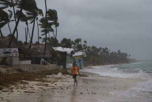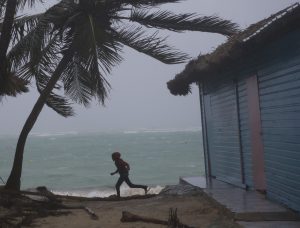
Santo Domingo, Sep 20 (EFE) .- Rains and wind gusts caused by the approaching category-2 Hurricane Maria have torn down trees and electricity poles in the eastern part of the Dominican Republic, local relief agencies reported Wednesday.
In a press conference, the Emergency Operations Center (COE) said road accidents have occured in the east of the country and has asked citizens to resume their usual commutes in the affected areas after the hurricane has passed.
Bavaro and Punta Cana were constantly hit by rains and wind gusts, which have intensified in the past hours, throughout Wednesday afternoon.
At 10 am local time (0200 GMT Thursday), Hurricane Maria’s eye was about 70 kilometers from Punta Cana in the east of the country, with maximum sustained winds of 175 km/h, according to the Dominican Meteorological Office (Onamet).
Onamet Deputy Director Francisco Holguin warned that Hurricane Maria could generate winds between 95 and 100 km off its center.
COE Director José Manuel Méndez said the country is expected to see about 300 and 350 millimeters of rain generally, while about 450 to 500 mm of rain is expected in the mountain areas.
He also said that the rainfall will cover the entire Dominican territory until Saturday, as the hurricane is moving along the northeastern and northern coasts of the country.

The COE declared 14 provinces under red alert and issued yellow and green alerts for the remaining provinces.
Public and private businesses and schools have been ordered by the government to suspend on Thursday.
The Onamet previously issued a hurricane warning for Cabo Engaño, near Punta Cana, to Puerto Plata in the north, and a tropical storm warning from Puerto Plata to Manzanillo Bay in the northwest.
A tropical storm warning has also been issued for Cabo Engaño to Punta Palenque in the south.
Hurricane Maria weakens to category 2, moves towards Dominican Republic
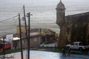
Miami, USA, Sep 20 (EFE).- Hurricane Maria late Wednesday weakened to a category 2 and was advancing towards the eastern part of the Dominican Republic with winds of up to 175 km/h, after having devastated Puerto Rico causing catastrophic floods.

The hurricane, which made landfall in Puerto Rico on Wednesday as category 4, was located 90 km east-northeast of Punta Cana, Dominican Republic, and was moving toward the northwest at 19 km/h, according to the United States National Hurricane Center (NHC).
The NHC said in the public advisory released at 8.00pm local time (24.00 GMT) that Hurricane Maria would continue moving towards the northwest, although a decrease in forward speed was expected through Thursday night and that a turn to the north-northwest would likely happen on Friday.
It was also expected to strengthen during the next day or two, and could regain major hurricane status by Thursday.
The forecasted track indicated that Maria’s eye would move away from the northwestern coast of Puerto Rico during Wednesday night.
It was expected to pass offshore of the northeastern coast of the Dominican Republic on Wednesday night and Thursday, before moving near the Turks and Caicos Islands and southeastern Bahamas Thursday night and Friday.
A hurricane warning was still in effect for Puerto Rico, Culebra and Vieques, from Cabo Engano to Puerto Plata in the Dominican Republic, the Turks and Caicos Islands, and the southeastern Bahamas.
